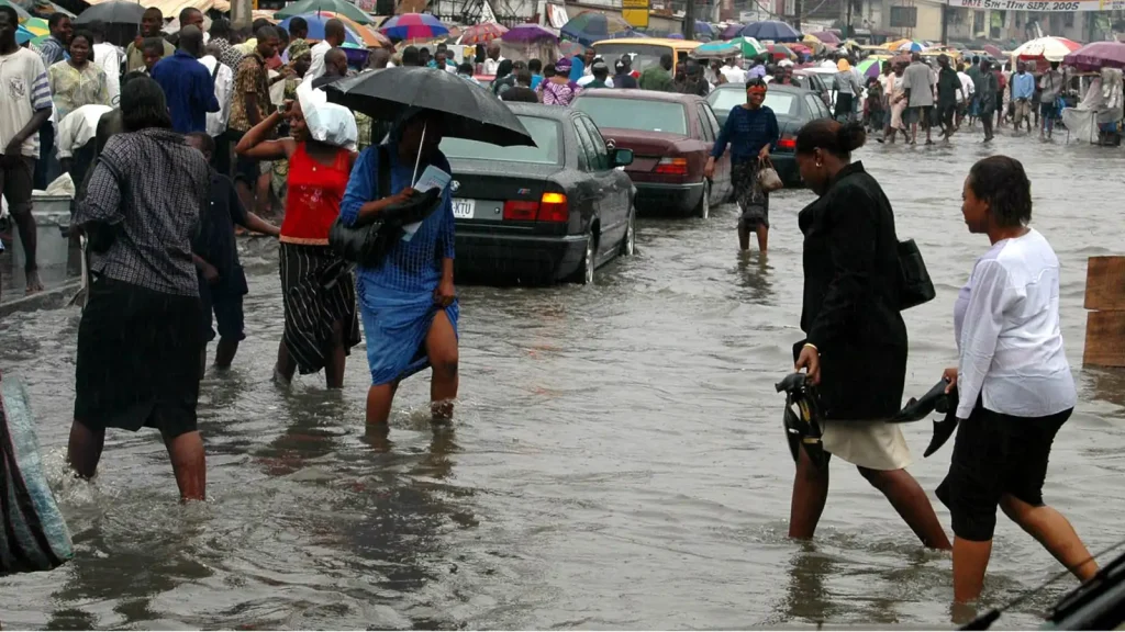
African coastlines have experienced a steady rise in sea levels for four decades. At the current pace, sea levels are projected to rise by 0.3 meters by 2030, affecting 117 million Africans.
The global rise in sea levels is an outcome of the buildup of greenhouse gas emissions that has resulted in an increase in ocean temperatures over the past century.

Rising ocean and atmospheric temperatures have resulted in the melting of the polar ice caps and thermal expansion (which causes the volume of water to increase, causing the increase in ocean levels.
Many cities in Africa, including Lagos, Nigeria, are sinking at a rate of more than 10 millimeters per year. This is more than twice the global average.
Sea level rise triggered by the Climate combines with land subsidence in some of Africa’s cities.
Sea level rises as the world warms. Water also expand with rising temperatures, and melting glaciers add fresh water to the sea’s volume.
The rate at which land is rising or sinking is also a factor here. Vertical land motion can amplify or dampen the rising water levels caused by climate change.
In a new report, researchers recently combined vertical land motion data captured by satellites with predictions of climate-driven sea level changes to produce more accurate—and alarming—estimates of flood risk The report focused on Africa’s 20 most populous coastal cities.
The team’s work is the first to focus on relative sea level rise in Africa, this means that it considers vertical land motion when predicting future patterns of inundation. The team presents its research at AGU’s Annual Meeting 2023 in San Francisco.
Earth’s seemingly rigid surface is actually not that rigid. Some areas of the surface are rising while many coastal areas, especially fast-growing, ones such as Lagos, Nigeria, whose urban population is projected to reach 20.6 million by 2030—are sinking. This phenomenon is called subsidence.
One of the main causes of land subsidence is groundwater extraction. To meet the needs of rapidly expanding populations, water is often pumped out faster than it can refill. According to Leonard Ohenhen, a geosciences doctoral student at Virginia Polytechnic Institute and State University (Virginia Tech) and one of the presenters at the AGU event, “It’s like wringing out a sponge,”
Ohenhen and his fellow researchers used a satellite technology called interferometric synthetic aperture radar, or InSAR, to calculate subsidence rates. “Imagine you throw a ball against the wall and it comes back to you, and you keep throwing it precisely,” Ohenhen explained. “If you move closer to the wall…you would notice that the ball will come to you quicker,” and if you move farther from the wall, the ball will return more slowly. InSAR technology works the same way, with satellites pinging signals to Earth and measuring the time it takes for the signals to return. By compiling several of the resulting images, researchers can estimate land’s changing elevation over time.
“Ten millimeters per year in African cities is big.…That’s fast. This is something that’s going to have impacts.”
“Ten millimeters [of subsidence] per year in African cities is big.…That’s fast. If you’re living in these cities…this is something that’s going to have impacts,” said Robert Nicholls, director of the Tyndall Center for Climate Change Research.
According to the team, some African coastal cities are sinking. at a rapid rate. They found high rates of subsidence—greater than 10 millimeters per year in most of the cities they studied, including Lagos; Alexandria, Egypt; and Douala, Cameroon. The global average rate of sea level rise is currently around 4.4 millimeters per year.
“The flooding in Libya and the extent of the loss of life and property that occurred there was a combination of sea level rise, extreme weather events, land subsidence, and then, importantly, weak infrastructures,” said Seyi Dasho, lead author of the research and a geosciences doctoral student at Virginia Tech.
Dasho and Ohenhen are both Nigerians. “Coming from Africa ourselves,” Ohenhen said, they recognize the significance of the subsidence. “You’re able to see how this is affecting people right now,” he said.
Dasho, Ohenhen, and their team combined subsidence rates gotten from InSAR data with five sea level change scenarios published by the Intergovernmental Panel on Climate Change.


